Antarctica 1912 edit.jpg: Porovnání verzí
Jump to navigation
Jump to search
(== Popis == AlfaRomeo) |
m (Zamkl stránku „Soubor:Antarctica 1912 edit.jpg“: Prevence...svůj požadavek můžete vložit na diskusní stránku ([Editace=Povolit jen správcům] (do odvolání) [Přesunutí=Povolit jen správcům] (do odvolání) [Načtení souboru=Povolit jen správcům] (do odvolání))) |
||
| (Není zobrazena jedna mezilehlá verze od stejného uživatele.) | |||
| Řádek 1: | Řádek 1: | ||
GIGANTICKÁ Mapa + Deutsch: Karte der Antarktis. Maßstab [ca. 1:40,000,000]. farbig, 34 × 41 cm. | |||
* English: Map of Antarctica. Scale [ca. 1:40,000,000]. Col., 34 × 41 cm. | |||
* Français: Carte de l'Antarctique, échelle 1:40 000 000e, couleur, 34 × 41 cm. | |||
* Português: Mapa da Antárctica. Escala [ca. 1:40,000,000]. Cor., 34 × 41 cm. | |||
* Date: 1912 | |||
* Source: Stieler Handatlas, 9. von Grund aus neubearb. und neugestochene Aufl. 8. berichtigter Abdruck. Verlag J. Perthes, Gotha, 1912. | |||
** This map is available from the United States Library of Congress's Geography & Map Division under the digital ID g9800.ct000774. | |||
* Author: Petermann, A.; Habenicht, H.; Böhmer, C. | |||
+ pochází z Wikimedia Commons, kde má status – This image is in the '''public domain''' because its copyright has expired. | |||
[[Kategorie:PD fotografie]] | |||
[[Kategorie:Gigantické fotografie]] | |||
[[Kategorie:Maps showing history]] | |||
Aktuální verze z 5. 11. 2025, 20:56
GIGANTICKÁ Mapa + Deutsch: Karte der Antarktis. Maßstab [ca. 1:40,000,000]. farbig, 34 × 41 cm.
- English: Map of Antarctica. Scale [ca. 1:40,000,000]. Col., 34 × 41 cm.
- Français: Carte de l'Antarctique, échelle 1:40 000 000e, couleur, 34 × 41 cm.
- Português: Mapa da Antárctica. Escala [ca. 1:40,000,000]. Cor., 34 × 41 cm.
- Date: 1912
- Source: Stieler Handatlas, 9. von Grund aus neubearb. und neugestochene Aufl. 8. berichtigter Abdruck. Verlag J. Perthes, Gotha, 1912.
- This map is available from the United States Library of Congress's Geography & Map Division under the digital ID g9800.ct000774.
- Author: Petermann, A.; Habenicht, H.; Böhmer, C.
+ pochází z Wikimedia Commons, kde má status – This image is in the public domain because its copyright has expired.
Historie souboru
Kliknutím na datum a čas se zobrazí tehdejší verze souboru.
| Datum a čas | Náhled | Rozměry | Uživatel | Komentář | |
|---|---|---|---|---|---|
| současná | 5. 11. 2025, 13:11 | 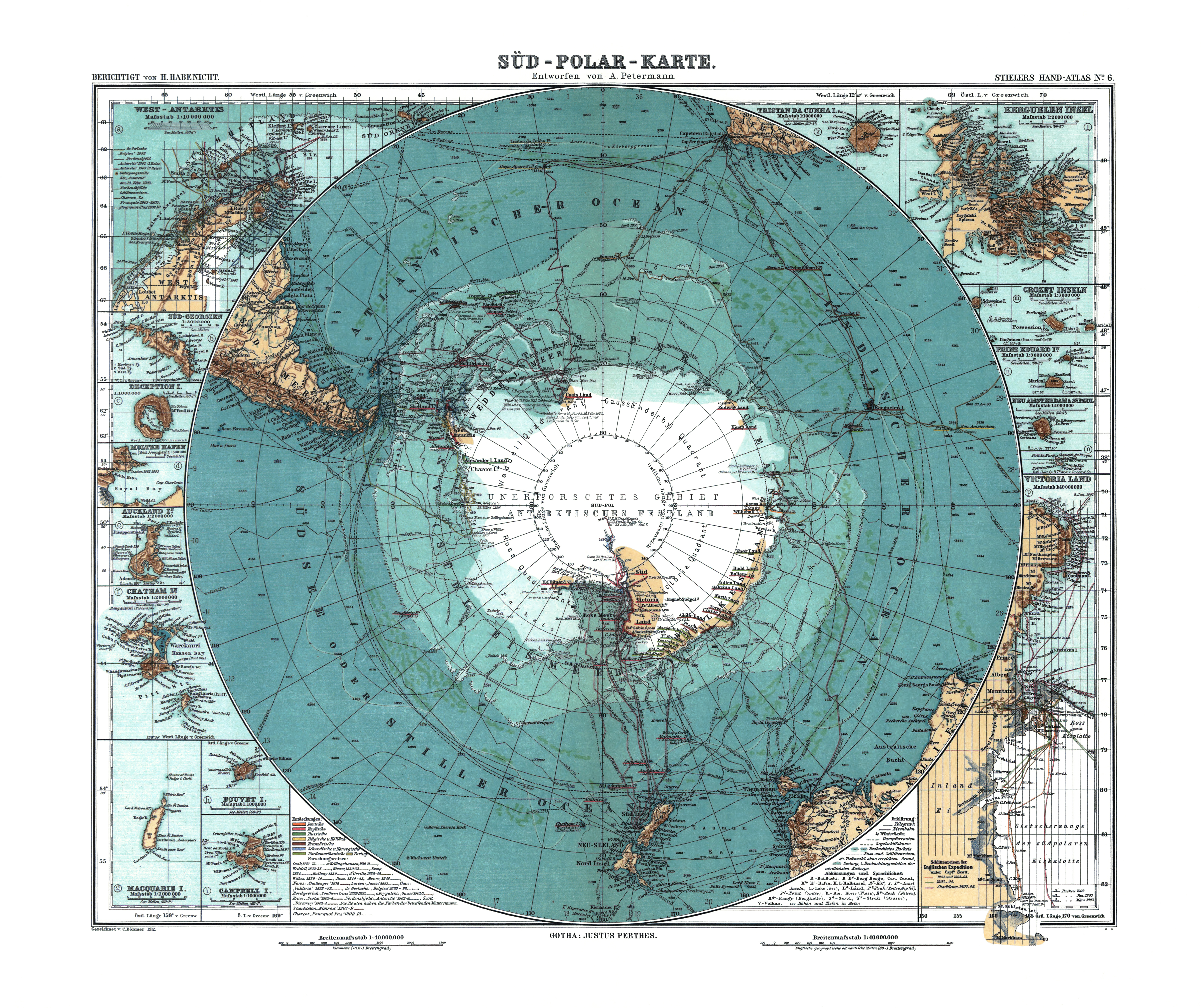 | 5 676 × 4 763 (17,84 MB) | Admin-allmultimedia (diskuse | příspěvky) | == Popis == AlfaRomeo |
Tento soubor nemůžete přepsat.
Využití souboru
Tento soubor nepoužívá žádná stránka.