Teplice District 2010 names TP CZ.png: Porovnání verzí
Jump to navigation
Jump to search
(== Popis == Locator117) |
(++) |
||
| Řádek 1: | Řádek 1: | ||
Mapa + Čeština: Obce okresu Teplice dle stavu k 1. lednu 2010 (34 obcí). Bílé linie o různé tloušťce představují hranice obcí, správních obvodů, okresů, krajů a států. | |||
* English: Municipalities of Teplice District as of January 1, 2010 (34 municipalities in total). White lines of variable thickness show boundaries of municipalities, administrative areas, districts, regions and nations. | |||
* Date: March 2010 | |||
* Source: Self made | |||
* Author: User:Miaow Miaow | |||
+ pochází z Wikimedia Commons, kde má status – I, the copyright holder of this work, release this work into the public domain. This applies worldwide. | |||
[[Kategorie:PD fotografie]] | |||
[[Kategorie:Locator maps of the Czech Republic]] | |||
Aktuální verze z 18. 4. 2026, 19:34
Mapa + Čeština: Obce okresu Teplice dle stavu k 1. lednu 2010 (34 obcí). Bílé linie o různé tloušťce představují hranice obcí, správních obvodů, okresů, krajů a států.
- English: Municipalities of Teplice District as of January 1, 2010 (34 municipalities in total). White lines of variable thickness show boundaries of municipalities, administrative areas, districts, regions and nations.
- Date: March 2010
- Source: Self made
- Author: User:Miaow Miaow
+ pochází z Wikimedia Commons, kde má status – I, the copyright holder of this work, release this work into the public domain. This applies worldwide.
Historie souboru
Kliknutím na datum a čas se zobrazí tehdejší verze souboru.
| Datum a čas | Náhled | Rozměry | Uživatel | Komentář | |
|---|---|---|---|---|---|
| současná | 18. 4. 2026, 18:49 | 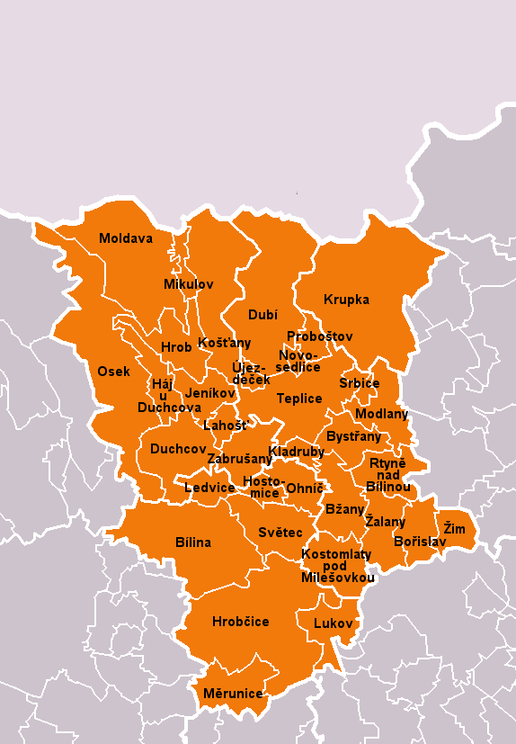 | 574 × 827 (53 KB) | Admin-allmultimedia (diskuse | příspěvky) | == Popis == Locator117 |
Tento soubor nemůžete přepsat.
Využití souboru
Tento soubor nepoužívá žádná stránka.