


Saint Kilda archipelago topographic map-en.png: Difference between revisions
From allmultimedia.cz
(== Popis == IG174) |
(++) |
||
| Line 1: | Line 1: | ||
Mapa + Description: | |||
* English: Topographic map in French of the archipelago of St Kilda in Scotland, United Kingdom. | |||
* Français : Carte topographique en français de l'archipel de Saint-Kilda en Écosse, Royaume-Uni. | |||
** UTM projection, WGS84 datum | |||
** Estimated scale: 1:250,000 (precision: about 62.5 m) | |||
* Date: March 2009 | |||
* Source: Map drawn using Landsat ETM+ imagery (public domain) | |||
* Author: Eric Gaba (Sting) | |||
{{GFDL}} | |||
[[Kategorie:Maps of the United Kingdom]] | |||


Latest revision as of 15:20, 29 April 2026
Mapa + Description:
- English: Topographic map in French of the archipelago of St Kilda in Scotland, United Kingdom.
- Français : Carte topographique en français de l'archipel de Saint-Kilda en Écosse, Royaume-Uni.
- UTM projection, WGS84 datum
- Estimated scale: 1:250,000 (precision: about 62.5 m)
- Date: March 2009
- Source: Map drawn using Landsat ETM+ imagery (public domain)
- Author: Eric Gaba (Sting)
File history
Click on a date/time to view the file as it appeared at that time.
| Date/Time | Thumbnail | Dimensions | User | Comment | |
|---|---|---|---|---|---|
| current | 15:16, 29 April 2026 | 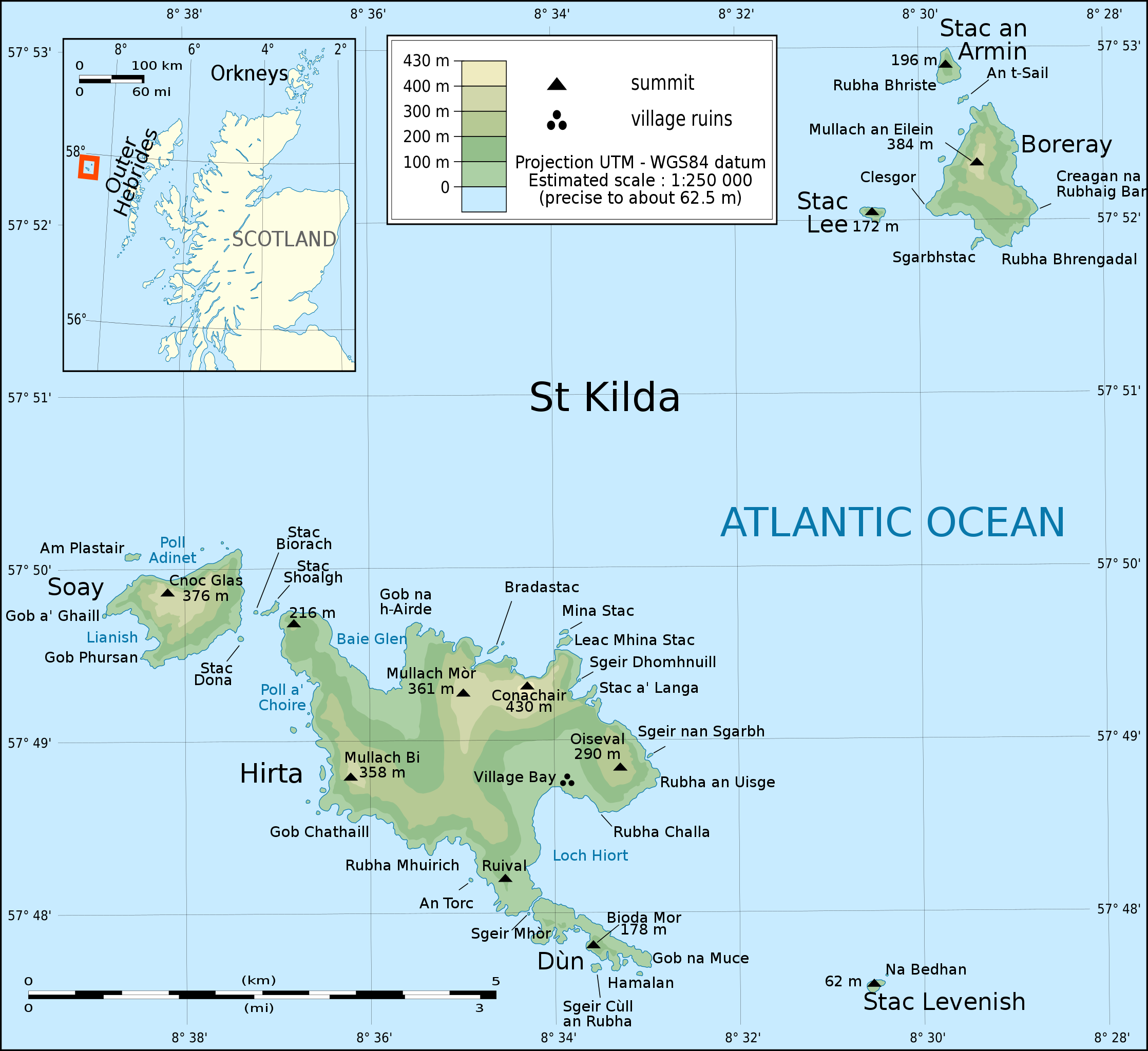 | 2,236 × 2,048 (542 KB) | Admin-allmultimedia (talk | contribs) | == Popis == IG174 |
You cannot overwrite this file.
File usage
The following 2 pages use this file:
