


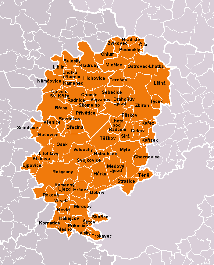
Rokycany District 2010 names RO CZ.png
From allmultimedia.cz
Size of this preview: 484 × 600 pixels. Other resolution: 702 × 870 pixels.

Original file (702 × 870 pixels, file size: 101 KB, MIME type: image/png)
Mapa + Description:
- Čeština: Obce okresu Rokycany dle stavu k roku 2010 (68 obcí). Bílé linie o různé tloušťce představují hranice obcí, správních obvodů, okresů a krajů. S územím okresu je rozsahem totožný správní obvod obce s rozšířenou působností Rokycany.
- English: Municipalities of Rokycany District as of 2010 (68 municipalities in total). White lines of variable thickness show boundaries of municipalities, administrative areas, districts and regions. The territory is identical with administrative area of Rokycany as a Municipality with Extended Competence.
- Date: March 2010
- Author: User:Miaow Miaow
Template:PD-self Kategorie:Locator maps of the Czech Republic
File history
Click on a date/time to view the file as it appeared at that time.
| Date/Time | Thumbnail | Dimensions | User | Comment | |
|---|---|---|---|---|---|
| current | 17:49, 18 April 2026 | | 702 × 870 (101 KB) | Admin-allmultimedia (talk | contribs) | == Popis == Locator117 |
You cannot overwrite this file.
File usage
There are no pages that use this file.
