


Usti nad Labem District 2008 names UL CZ.png
From allmultimedia.cz
No higher resolution available.
Usti_nad_Labem_District_2008_names_UL_CZ.png (556 × 567 pixels, file size: 40 KB, MIME type: image/png)
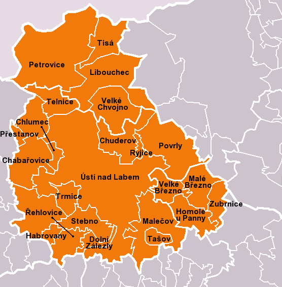
Mapa + Čeština: Obce okresu Ústí nad Labem dle stavu k 1. lednu 2010 (23 obcí). Bílé linie o různé tloušťce představují hranice obcí, správních obvodů, okresů a států.
- English: Municipalities of Ústí nad Labem District as of January 1, 2010 (23 municipalities in total). White lines of variable thickness show boundaries of municipalities, administrative areas, districts and nations.
- Date: February 2010
- Source: Self made
- Author: User:Miaow Miaow
+ pochází z Wikimedia Commons, kde má status – I, the copyright holder of this work, release this work into the public domain. This applies worldwide.
Kategorie:PD fotografie Kategorie:Locator maps of the Czech Republic
File history
Click on a date/time to view the file as it appeared at that time.
| Date/Time | Thumbnail | Dimensions | User | Comment | |
|---|---|---|---|---|---|
| current | 17:49, 18 April 2026 | | 556 × 567 (40 KB) | Admin-allmultimedia (talk | contribs) | == Popis == Locator117 |
You cannot overwrite this file.
File usage
There are no pages that use this file.
