1922 world map.png
Jump to navigation
Jump to search

Velikost tohoto náhledu: 800 × 543 pixelů. Jiná rozlišení: 2 560 × 1 739 pixelů | 3 495 × 2 374 pixelů.
Původní soubor (3 495 × 2 374 pixelů, velikost souboru: 17,29 MB, MIME typ: image/png)
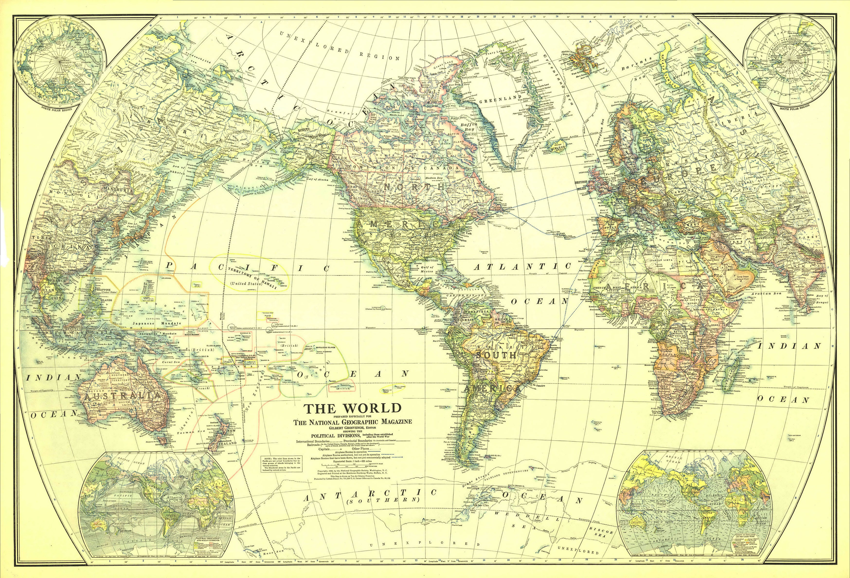
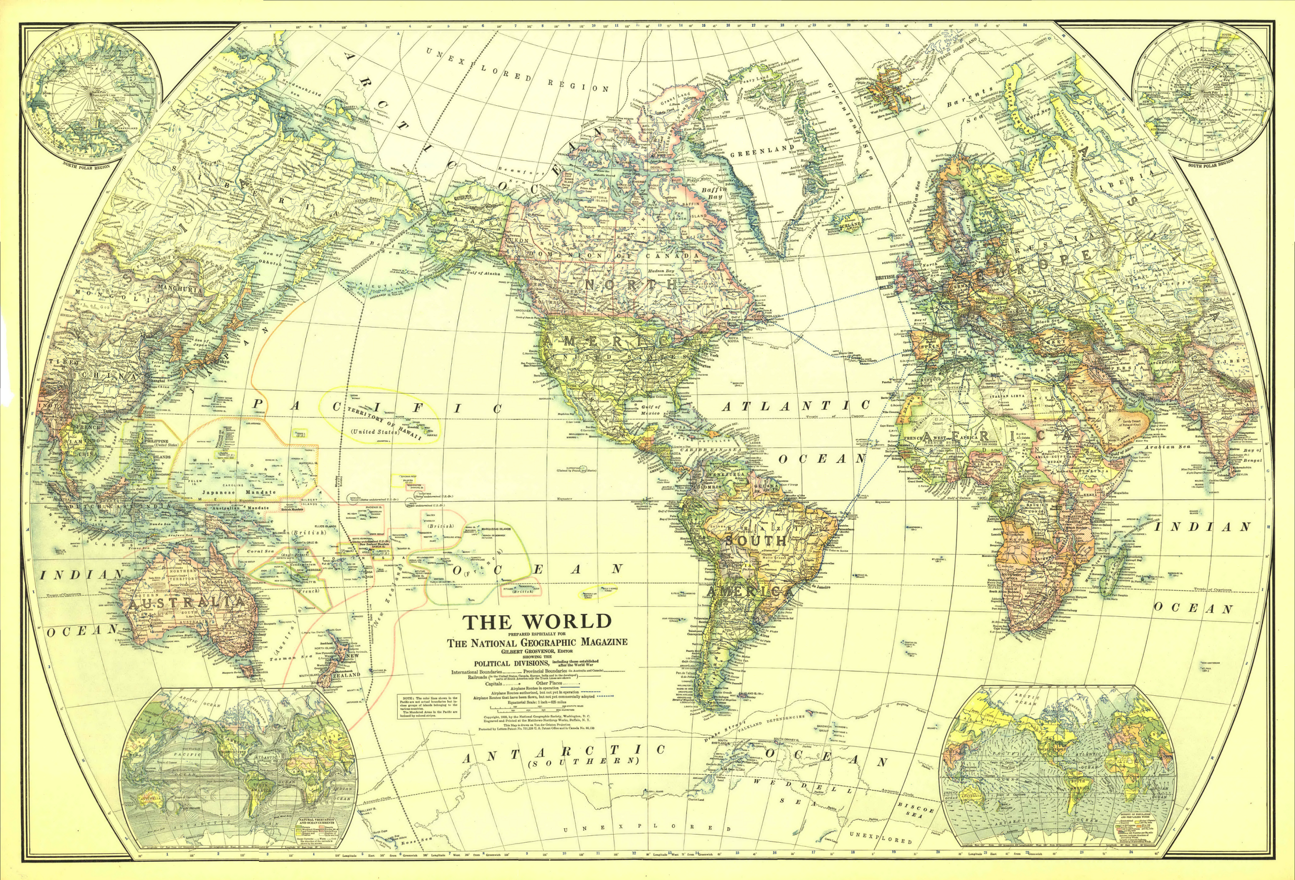
GIGANTICKÁ mapa + Description:
- English: Map of the World in 1922
- Drawn with Van der Grinten projection. Scale on equator 1 inch = 625 miles (1 : 39,600,000)
- Extra maps in the corners: North and South polar regions, natural vegetation and ocean currents, density of population and prevailing winds.
- Date: December 1922
- Source: The Complete National Geographic Maps Collection
- Author: National Geographic Society
+ pochází z Wikimedia Commons, kde má status – This media file is in the public domain in the United States.
This applies to U.S. works where the copyright has expired, often because its first publication occurred prior to January 1, 1930, and if not then due to lack of notice or renewal.
Historie souboru
Kliknutím na datum a čas se zobrazí tehdejší verze souboru.
| Datum a čas | Náhled | Rozměry | Uživatel | Komentář | |
|---|---|---|---|---|---|
| současná | 22. 9. 2025, 13:59 | | 3 495 × 2 374 (17,29 MB) | Admin-allmultimedia (diskuse | příspěvky) |
Tento soubor nemůžete přepsat.
Využití souboru
Tento soubor nepoužívá žádná stránka.